
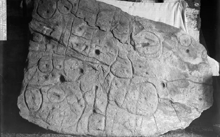
An intricately carved stone slab from the early Bronze Age found in France has been identified as the oldest cartographical representation of a known territory in Europe.
The Bronze Age stone slab measures 3.86 m long and 2.1 m wide, and dates from between 2150 and 1600 BCE.


It was found in the Leuhan parish, Finistère Department, France, within an early Bronze Age barrow in 1900. It was partly broken, presumably in Antiquity, with the upper part missing.
 The broken slab was re-used in the burial of the Saint-Bélec towards the end of the early Bronze Age (c. 1900-1640 BCE).
It was moved to a private museum in 1900 before the collection was acquired by the Musée des Antiquités nationales in 1924.
Until the 1990s, it was stored in a niche in the castle moat. Finally, in 2014, it was found in a cellar of the castle.
Bournemouth University’s Dr. Clément Nicolas and colleagues started carrying out high-resolution 3D surveys and photogrammetry of the Saint-Bélec slab in 2017, recording its surface and engravings.
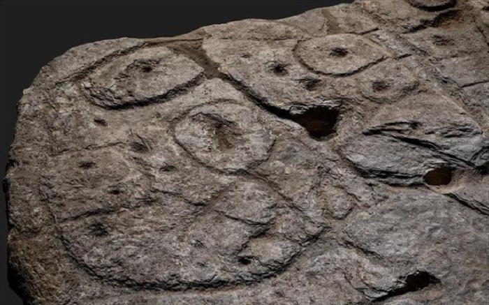
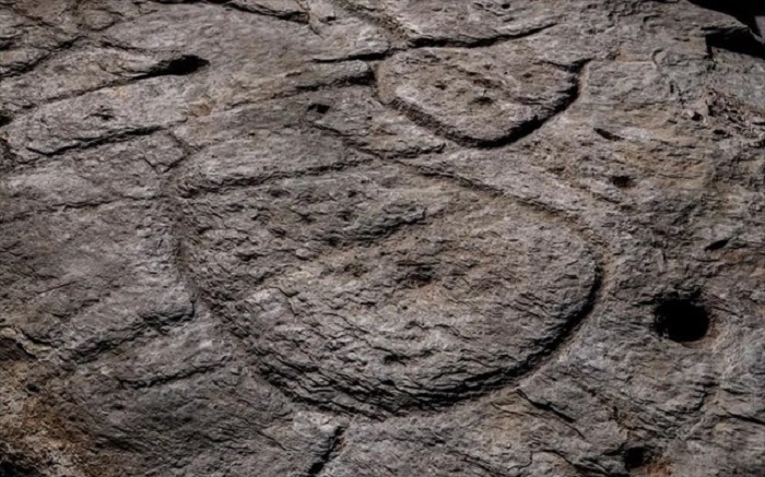 They found that the slab bears many of the elements expected in a prehistoric map, including repeated motifs joined by lines to give the layout of a map.
The slab’s topography was purposely 3D-shaped to represent the valley of the River Odet, whilst several lines appear to depict the river network.
The researchers also analyzed the similarities between the engravings on the slab and elements of the landscape.
They showed that the territory represented on the slab appears to relate to an area of about 30 km by 21 km, along the course of the River Odet.
 The central motif, interpreted as a symbol of an enclosure, suggests that the center of a territory might have existed within three river springs: the Odet, the Isole, and the Stêr Laër.
“The central motif on the Saint-Bélec slab could be interpreted as a central place of an early Bronze Age territory, extending over an area of 545 to 843 km2,” the scientists said.
“One outstanding question about the Saint-Bélec slab is why it was made? One possibility is that such a territorial depiction was a material and symbolic act enforcing.”
“Set alongside the contemporary development of field systems in Brittany making the slab perhaps suggests the appearance of a new form of land tenure, while the distribution of elite graves is closely linked to soil fertility.”
“Against this background, we can hypothesize that the Saint-Bélec slab was used as a cadastral plan for managing the territory and controlling land.”
A paper describing the findings was published in the journal Bulletin de la Société préhistorique française.
Source: www.sci-news.com